Draft Coffs Creek Floodplain Risk Management Study and Plan
Consultation has concluded
Consultation concluded: Thank you to everyone who contributed feedback—Council endorsed the 2025 Coffs Creek Floodplain Risk Management Study and Plan on 19 June 2025. This updated plan enhances flood modelling with improved terrain data and rainfall analysis, and outlines prioritised strategies to reduce flood risk across the catchment. To view the adopted plan, visit: Coffs Creek and Park Beach Flood Risk Management Plans.
Project Overview
Under the NSW Government’s Flood Prone Land Policy, Councils are primarily responsible for managing flood affected areas to help reduce risk to people and property.
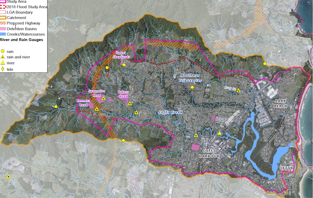
The City appointed external consultant WMAwater to develop a new Floodplain Risk Management Study and Plan for the Coffs Creek catchment.
The study reviewed the current flood model for Coffs Creek to ensure it aligns with current best practices and provides a new Coffs Creek Floodplain Risk Management Study and Plan.
The outcomes from this study will be used by the State Emergency Service (SES) during flood emergencies, and by the City to guide development in flood-prone areas and inform future flood mitigation efforts.
The key reasons for doing the study are:
Provide updated flood mapping datasets
Review of existing flood models and risk management strategies
To better understand flood risks and behaviour using the latest national flood guidelines
To improve the information used in land use planning and development decisions
To create flood management measures that fit the area and are acceptable to the local community in terms of cost, social impact, and environmental sustainability.
Provide enhanced tools for flood emergency planning and long-term floodplain management
Next Steps
Planning for the implementation of the 2025 Coffs Creek Floodplain Risk Management Plan will now be undertaken by the City.