Project Overview
We are reviewing the Flood Study and Floodplain Risk Management Plan for the Middle Creek catchment.
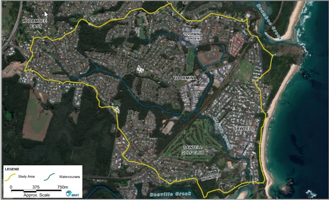
This study will provide a better understanding of flooding in the catchment and how best to manage these flood risks into the future. The Middle Creek catchment encompasses the suburbs of Sawtell, Toormina and Boambee East.
This study will improve the accuracy and resolution of Councils existing flood mapping by making use of recently available high resolution topographic data in conjunction with best practice flood modelling software.
This mapping will be used to identify flood risks and possible flood mitigation options.
AnContinue reading
Project Overview
We are reviewing the Flood Study and Floodplain Risk Management Plan for the Middle Creek catchment.
This study will provide a better understanding of flooding in the catchment and how best to manage these flood risks into the future. The Middle Creek catchment encompasses the suburbs of Sawtell, Toormina and Boambee East.
This study will improve the accuracy and resolution of Councils existing flood mapping by making use of recently available high resolution topographic data in conjunction with best practice flood modelling software.
This mapping will be used to identify flood risks and possible flood mitigation options.
An online version of the final revised Flood Study and Floodplain Risk Management Plan documents for the Middle Creek catchment will be freely available to the public at the conclusion of the study.
Who is Responsible?
The study is being overseen by the Coffs Harbour City Council Floodplain Risk Management Committee and will include public consultation to ensure that the views of the community are properly considered.
The Committee consists of Councillors, Council Staff, State Emergency Service, State Government representatives and community representatives. BMT, an independent company specialising in flooding and floodplain risk management, will undertake the study. The NSW Department of Planning, Industry and Environment is providing financial and technical assistance.
Key Study Outputs
Floodplain Risk Management considers the consequences of flooding on the community and aims to develop appropriate floodplain management measures to minimise and mitigate the impact of flooding. This incorporates the existing flood risk associated with current development, and future flood risk associated with future development and changes in land use.
The outcomes of the review will improve the existing Floodplain Risk Management Study and Plan, and will contain an appropriate mix of management measures and strategies, to help direct and coordinate the responsibilities of Government and the community in undertaking immediate and future flood management works and initiatives.
Information from the study will be used by the State Emergency Service (SES) during flood emergencies and will be used by Council to manage development in flood-affected areas.