Share Draft Updated Coffs Harbour LGA Flood Mapping on FacebookShare Draft Updated Coffs Harbour LGA Flood Mapping on X (formerly Twitter)Share Draft Updated Coffs Harbour LGA Flood Mapping on LinkedinEmail Draft Updated Coffs Harbour LGA Flood Mapping link
Consultation has concluded
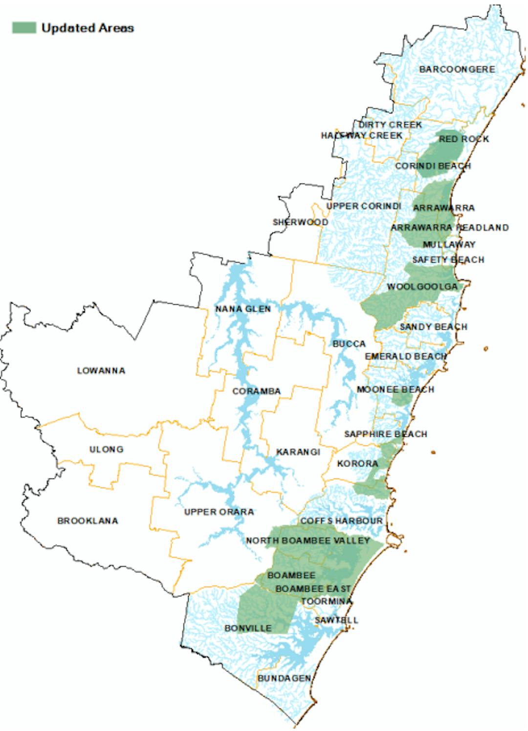
At its ordinary meeting of 14 November 2019, council resolved to endorse the draft updated flood mapping data sets and place them on public exhibition.
Council’s online mapping system available to the public hosts a range of mapping information, including the 100 year ARI flood extent, the flood planning level area, indicative flood areas, and 100 year ARI flood depths from council’s flood studies. The flood mapping layers are an ever evolving data set as new models are developed, existing models are revised and improved, and catchments change with new development and flood mitigation works.
The updated flood mapping data set includes model information with more accurate terrain data, rainfall data and computer modelling techniques, hence increasing the accuracy in the data set. This will improve the flood information accuracy around Woolgoolga, the Boambee-Newport’s catchment, Bonville, and various other creeks.
The exhibition period is from Wednesday 4th December 2019 to close of business 3rd January 2020. The Draft data sets can be found on councils online mapping tool HERE
On this screen, you have the option of uploading a prepared submission or typing your submission in the field provided.
In order for Council to consider electronic
submissions each submission must:
a) contain legitimate contact details;
b) be received by Council during the submission period; and
c) be correctly or ‘properly’ made to include the proposal title
and reasons for the submission.
Submissions which do not satisfy the above criteria may not be considered. Further details can be found in Council's Submission Policy.
Council is committed to openness and transparency in its decision making processes. The Government Information (Public Access) Act 2009 requires Council to provide public access to information held unless there are overriding public interest considerations against disclosure. Any submissions received will be made publicly available unless the writer can demonstrate that the release of part or all of the information would not be in the public interest. However, Council would be obliged to release information as required by court order or other specific law.
Consultation has concluded
Share Electronic Submissions on FacebookShare Electronic Submissions on X (formerly Twitter)Share Electronic Submissions on LinkedinEmail Electronic Submissions link