FAQs
- permit large lot residential development on the subject site,
- ensure that this section of the East Bank Road locality is developed based on sound planning and design principles, and
- ensure that the rezoning and the reduction in minimum lot size is consistent with the broad strategic direction for the locality as outlined in the North Coast Regional Plan 2041 and Chapter 6 (Large Lot Residential Lands) of the City’s Local Growth Management Strategy 2020.
What is a Planning Proposal?
A planning proposal is a document that explains the intent and justification for a proposed change to a local environmental plan (LEP).
An LEP provides a framework that guides planning decisions through land use zoning and development controls. Land use zoning determines how land can be used (for example, for housing, business, industry, or recreation) and development controls set guidelines such as the maximum building height allowed.
Changes to LEPs keep local planning controls up to date. The process of making and amending LEPs aims to make sure these changes are in keeping with broader strategies and deliver good planning outcomes.
Essentially, the preparation of a planning proposal is the first step in making a change to an LEP. Further information on the process for amending an LEP can be found on the NSW Government’s website.
What does rezoning mean?
Land use zoning determines how land can be used (for example, for housing, business, industry, or recreation). Rezoning is the process for changing land-use zones or controls by making or amending an LEP.
What land does this planning proposal relate to?
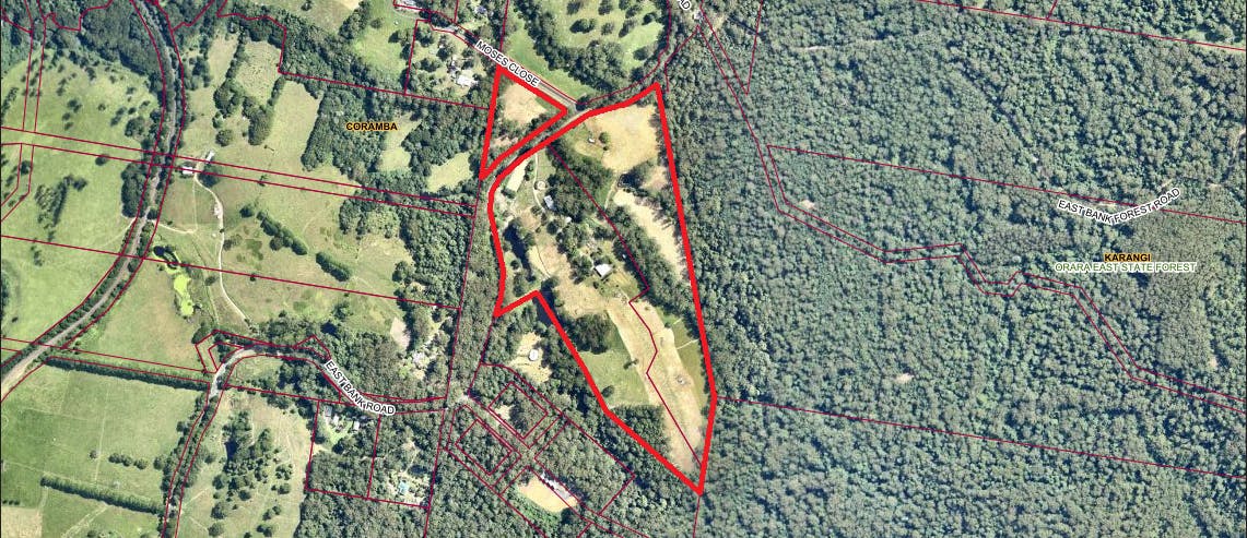
The site is located at 218 East Bank Road, Coramba. The subject land is currently located within Zone RU2 Rural Landscape under Coffs Harbour LEP 2013.
What are the objectives of the planning proposal?
The objectives of this planning proposal are to amend Coffs Harbour LEP 2013 to:
What changes will be made because of the planning proposal?
The objective of this planning proposal is to amend Coffs Harbour LEP 2013 to change the land use zoning of land located at 218 East Bank Road, Coramba from Zone RU2 Rural Landscape to part Zone R5 Large Lot Residential and part Zone C2 Environmental Conservation.
The planning proposal also looks to reduce the minimum lot size from 40 hectares to 8000 m2.
It is also necessary to amend maps contained within Coffs Harbour DCP 2015 to align with the proposed LEP amendment, including updates to the front, side and rear setbacks maps, as well as the preservation of vegetation map. The mapping changes can be viewed by clicking the following link:
Is this a development application?
Is this a development application?
No. A planning proposal is a document that proposes changes to planning controls (i.e. a change to a land use zone or control) in a local environmental plan. A development application is an application for approval to carry out development that is permitted under zoning or other controls in the LEP.
Further information on the development assessment process is provided on the City’s Website.
