FAQ
What is the purpose of the Planning Proposal?
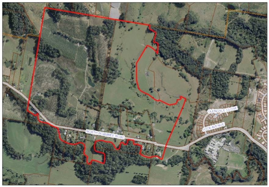
The Planning Proposal applies to certain lands in North Boambee Valley, west of Bishop Druitt College and the future Pacific Highway bypass. The lands are accessed by the Pacific Highway and North Boambee Road. Currently the site is predominantly zoned RU2 Rural Landscape and E2 Environmental Conservation under Coffs Harbour Local Environmental Plan (LEP) 2013. This Planning Proposal describes the integrated development of the release area for mainly residential purposes.
The Planning Proposal describes:
* Amending the zoning of parts of the North Boambee Valley locality from RU2 Rural Landscape to R2 Low Density Residential which will provide a maximum of approximately 820 new residential allotments;
* Review of lands of environmental importance and applying appropriate zones of E2 Environmental Conservation and E3 Environmental Management; and
* Provision of a new neighbourhood park by applying a zone of RE1 Public Recreation to that land.
Other LEP maps which are proposed to be amended (consistent with the proposed change to the land use zones) are the:
* Minimum Lot Size map;
* Terrestrial Biodiversity, Drinking Water, Riparian lands and Watercourses map; and
* Land Reservation Acquisition map.
What are the objectives of the Draft DCP?
The draft Coffs Harbour DCP 2015: Chapter G8A North Boambee Valley (West) identifies appropriate infrastructure and utility services required within the new urban release area, to ensure that development within the urban release area is responsive to the environmental context of the land.
To facilitate this, the Draft DCP includes a Masterplan for the urban release area, required road design/construction standards, and environmental requirements including protection of riparian areas. It is proposed to also amend a number of maps contained within the draft DCP to correspond with the new zone layout in the proposed amended LEP.
What are the objectives of the Draft Developer Contributions Plan?
The draft Developer Contributions Plan identifies infrastructure which is required to service the proposed residential precincts, provides detailed costs for those facilities, and the means by which the funds are raised by the levying of developer contributions. This ensures that any development of land in North Boambee Valley (West) undertaken in an orderly and economically sustainable way.
