Woolgoolga bike lane trial
Consultation has concluded.

Thank you to everyone who participated in the survey. We are currently reviewing the feedback and will report to Council in the coming months. Participants who provided feedback will receive an update before the Council meeting.
About the project
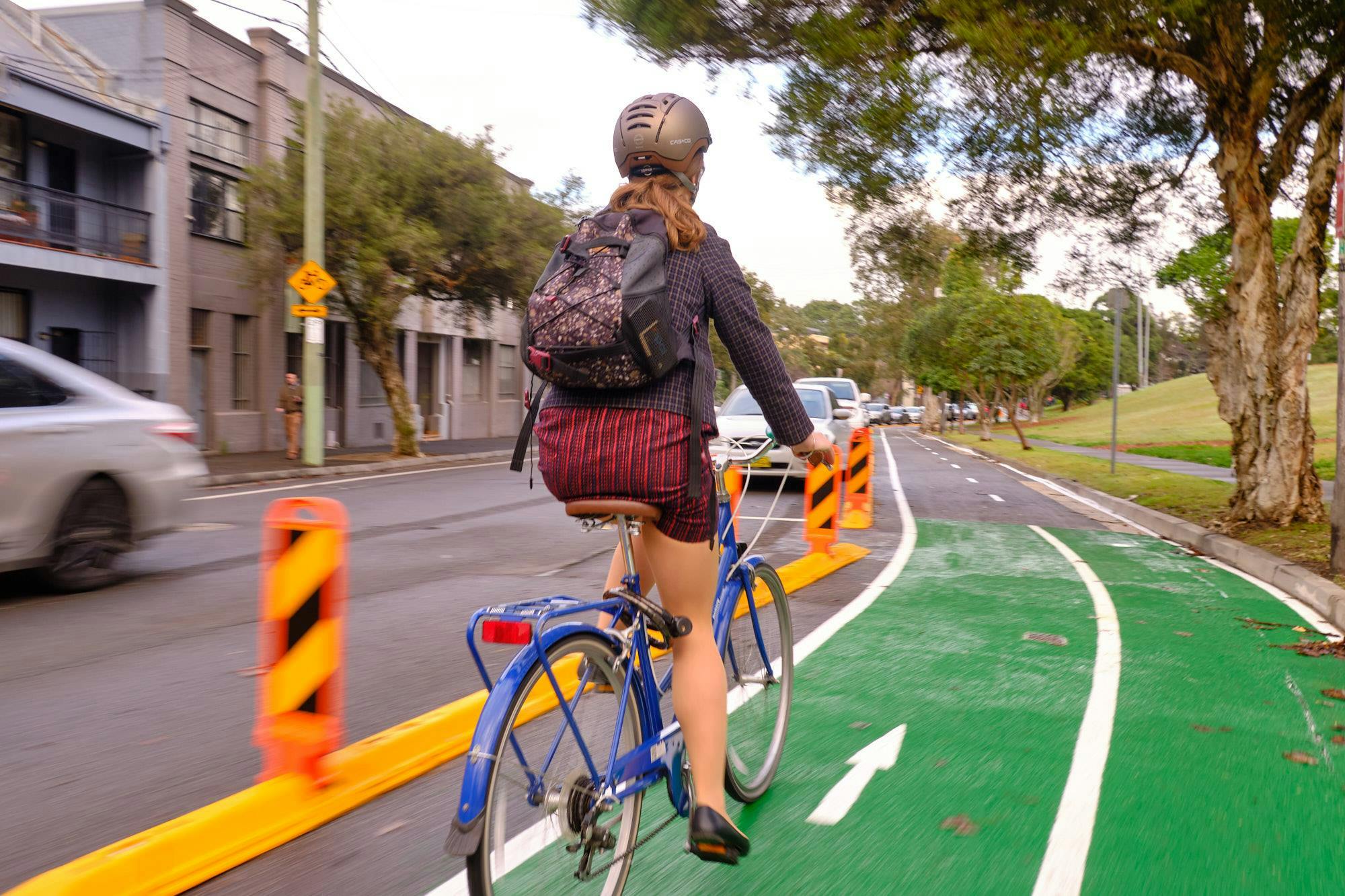
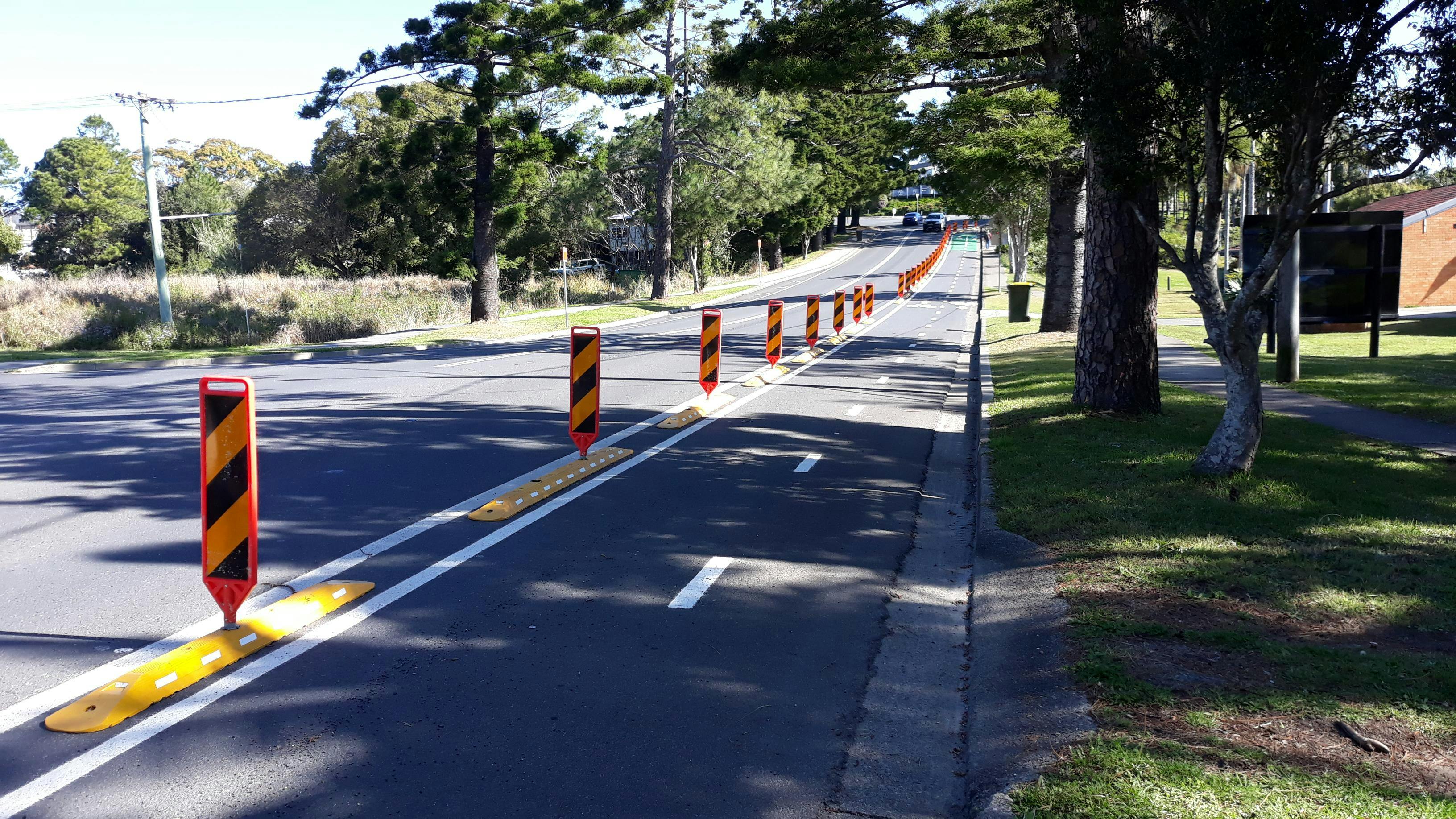
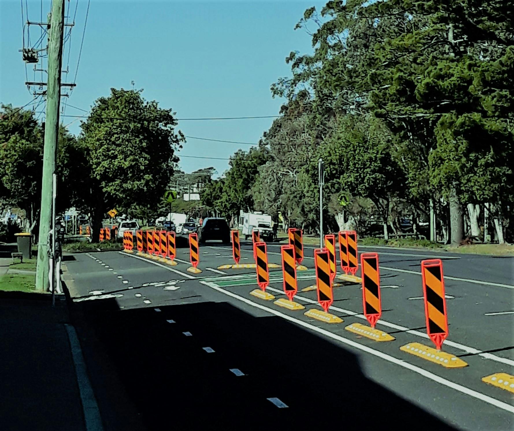
A temporary bike lane has been installed along Beach Street between River Street and Wharf Street in Woolgoolga, as part of the NSW Government’s Streets as Shared Spaces program.
We are using this opportunity to trial a protected on-road bike lane to see how effective this type of bike lane may be in providing a safer cycling experience for residents and visitors.
The bike lane includes:
- a protected on-road bike lane from River Street to Boundary Street, along Beach Street
- a new wider shared footpath between Boundary Street and Wharf Street, adjacent to Beach Street
The need for a bike lane is identified in the Woolgoolga Town Centre Masterplan (adopted in 2018). The long-term aim for this bike lane is to create a continuous link from the beach to West Woolgoolga along Beach Street and Clarence Street, including a safer crossing of Solitary Islands Way.
Continuing to listen to your feedback
The Woolgoolga bike lane is a six-month trial from September 2022 extending until February 2023. Community surveys were conducted early in the Trial and we are now asking the community to give us their thoughts in a second survey in the final weeks of the official trial period.
We know there are a wide range of opinions on the suitability of this type of bike lane and how we can make it better, safer and more appealing.
- Significant consultation has occurred in 2021 and 2022 with businesses, residents adjoining the route, cyclists and various other stakeholders including property owners. This preliminary consultation helped to define the extent of the trial route.
- In September/October last year more than 230 people completed the online community survey on Have Your Say, to share their thoughts on the trial.
- An additional survey was conducted by independent researchers over two days in Woolgoolga, seeking input from randomly selected people found near the route. More than 50 people contributed their views in this survey.
- In 2023, we are again conducting the general community online survey, from 13 February to 26 February. Independent researchers will also hold another random survey on the street during February. Your input will help us to evaluate the success of the route; assess how much it is being used and; explore where improvements can be made in future cycleway connections for Woolgoolga.
Consultation has concluded.
Please provide us with your initial thoughts on the bike lane trial. If you wish to ask a question please first check the Frequently asked Questions section of this page. If the answer you are after is not there please leave your question below and we will get back to you.
Please note we will be undertaking more formal consultation in the coming months to gain your feedback on the bike lane trial.
Signup Banner